
Araştırma Projesi
Solartalya
Solartalya, haritada seçtiğiniz bir çatının güneş enerjisi potansiyelini açık verilerle tahmin eden bir araştırma ön izlemesidir. Kullanılabilir çatı alanını, yıllık üretimi, olası geliri ve geri dönüş süresini kabaca hesaplar.
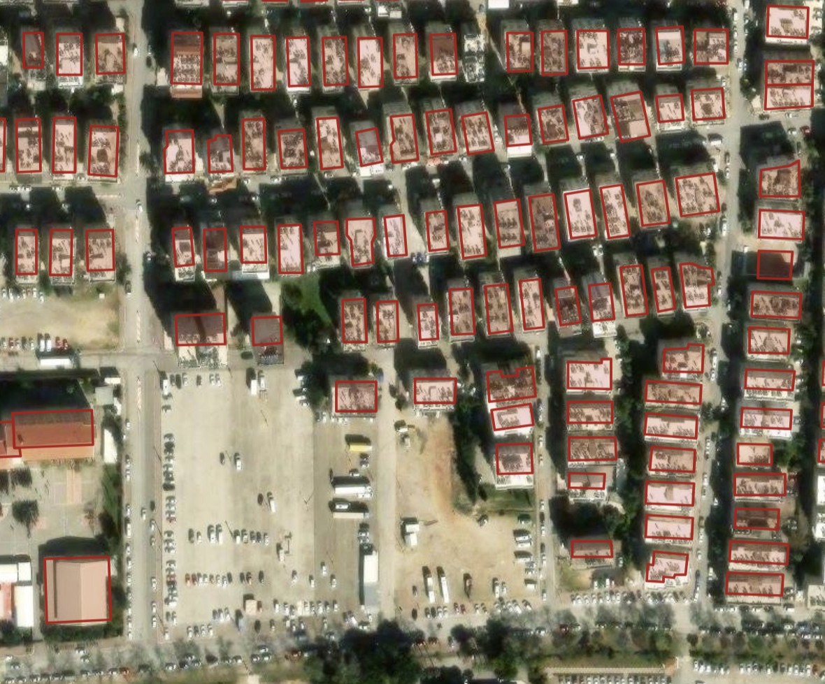
Ekran görüntüsündeki uydu görüntüsü: © Esri ve veri sağlayıcıları. Bina sınırları: © OpenStreetMap katkıda bulunanlar.
Nasıl çalışır
- Bir adres arar ya da uydu haritasını istediğiniz yere kaydırırsınız.
- Araç, görünen binaların sınırlarını açık harita verisinden alır; bir çatıya dokunursunuz ve alanı hesaplanır.
- O konum için geçmiş güneşlenme verisinden yıllık üretimi tahmin eder.
- Herkese açık liste fiyatlarıyla olası geliri ve geri dönüş süresini gösterir.
Sonuçlar kaba tahminlerdir; teklif, mühendislik keşfi ya da yatırım tavsiyesi değildir.
Kaynaklar ve katkı bildirimleri
- Uydu görüntüsü: Esri World Imagery. Tiles © Esri. Source: Esri, i-cubed, USDA, USGS, AEX, GeoEye, Getmapping, Aerogrid, IGN, IGP, UPR-EGP, and the GIS User Community.
- Bina sınırları ve adres verisi: © OpenStreetMap katkıda bulunanlar, Open Database License (ODbL). openstreetmap.org/copyright
- Adres arama: Nominatim ve Photon (komoot), OpenStreetMap verisiyle.
- Hava verisi: Open-Meteo.com, CC BY 4.0.
- Uydu verisi: Değiştirilmiş Copernicus Sentinel verisi içerir.
- Yazılım: Leaflet harita kütüphanesi (BSD 2-Clause) ve Lit arayüz kütüphanesi (BSD 3-Clause).
Research Project
Solartalya
Solartalya is a research preview that estimates the solar potential of a roof you pick on a map, using open data. It gives a rough figure for the usable roof area, the yearly yield, the possible revenue and the payback time.
Satellite imagery in the screenshot: © Esri and its data providers. Building outlines: © OpenStreetMap contributors.
How it works
- You search for an address or move the satellite map to the place you want.
- The tool loads the outlines of the buildings in view from open map data; you tap a roof and its area is worked out.
- It estimates the yearly yield from historical sunshine data for that location.
- It shows the possible revenue and payback time using publicly listed prices.
The results are rough estimates, not an offer, an engineering survey or investment advice.
Sources and credits
- Satellite imagery: Esri World Imagery. Tiles © Esri. Source: Esri, i-cubed, USDA, USGS, AEX, GeoEye, Getmapping, Aerogrid, IGN, IGP, UPR-EGP, and the GIS User Community.
- Building outlines and address data: © OpenStreetMap contributors, Open Database License (ODbL). openstreetmap.org/copyright
- Address search: Nominatim and Photon (komoot), using OpenStreetMap data.
- Weather data: Open-Meteo.com, CC BY 4.0.
- Satellite data: contains modified Copernicus Sentinel data.
- Software: the Leaflet map library (BSD 2-Clause) and the Lit interface library (BSD 3-Clause).